£125.00


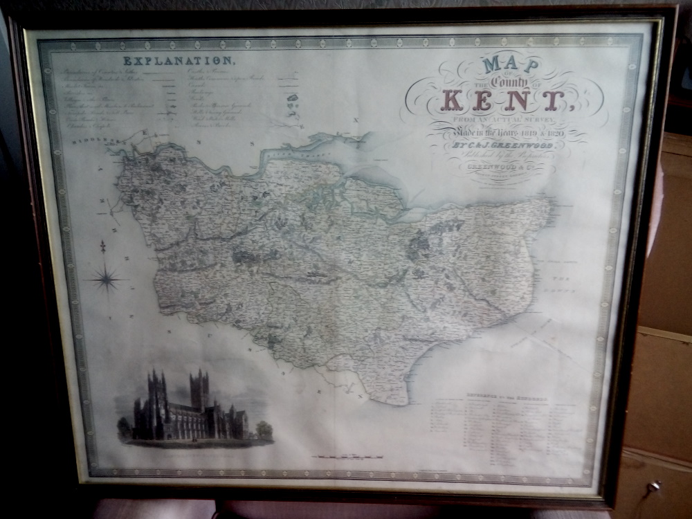
This is an genuine original hand coloured map of the County of Kent with a finely engraved view of Canterbury Cathedral in the lower left corner. The map was originally published in Christopher and James Greenwood’s “Atlas Of The Counties Of England”, published in 1829. This copy has a vertical fold down its centre.
The map is to a scale of 1 inch to 3 miles which allows for details such as turnpike roads, toll bars, wind and water mills, and many other features to be shown. There is a key in the upper left corner.
The hand coloured map measures approx. 28 x 23 inches and is in excellent original condition with no tears or repairs and no stains. There is virtually no foxing.
Framed and glazed with safety glass.