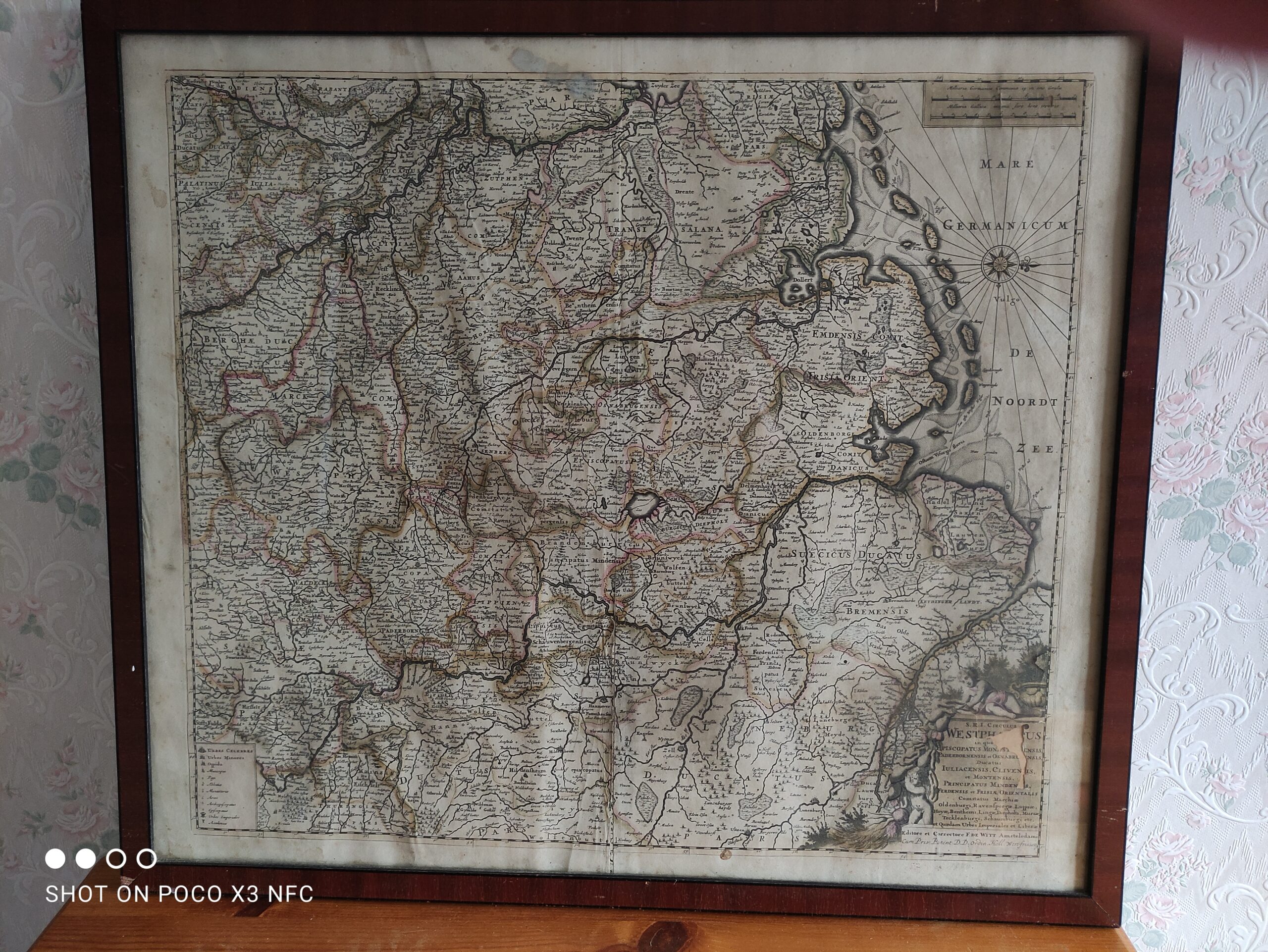
1680 North Germany-map by F. De Wit: showing Rheinland-Westfalen & Nieder Sachsen-£65.00
![](https://i0.wp.com/reddlyoncurios.uk/wp-content/uploads/2021/03/g2.jpg?resize=769%2C1024&ssl=1)
![](https://i0.wp.com/reddlyoncurios.uk/wp-content/uploads/2021/03/g3.jpg?resize=769%2C1024&ssl=1)
![](https://i0.wp.com/reddlyoncurios.uk/wp-content/uploads/2021/03/g8.jpg?resize=769%2C1024&ssl=1)
![](https://i0.wp.com/reddlyoncurios.uk/wp-content/uploads/2021/03/g7.jpg?resize=769%2C1024&ssl=1)
![](https://i0.wp.com/reddlyoncurios.uk/wp-content/uploads/2021/03/g5.jpg?resize=769%2C1024&ssl=1)
![1680 Rheinland-Westfalen & Nieder Sachsen. Hand-coloured antique map of North Germany by F. De Wit. £65.00](https://i0.wp.com/reddlyoncurios.uk/wp-content/uploads/2021/03/g6.jpg?resize=769%2C1024&ssl=1)
An original copper engraved hand coloured map from the Composite Atlas by F. De Wit of Amsterdam, circa 1680.
The map is in very good overall condition for a 340 year old map with some minor marking along the margins, scattered light foxing, and a small loss of paper in the bottom right cartouche. Framed and glazed with safety glass. The frame measures 24 ½ x 21 ½ inches.